Datoteka:1827 Finley Map of Turkey in Europe, Greece and the Balkans - Geographicus - TurkeyEurope-finley-1827.jpg

Veličina ovog prikaza: 467 × 599 piksela. Ostale razlučivosti: 187 × 240 piksela | 374 × 480 piksela | 599 × 768 piksela | 798 × 1.024 piksela | 2.339 × 3.000 piksela.
Vidi sliku u punoj veličini (2.339 × 3.000 piksela, veličina datoteke: 1,94 MB, MIME tip: image/jpeg)
| Ova je datoteka sa Zajedničkog poslužitelja i mogu je rabiti drugi projekti. Opis s njezine stranice s opisom datoteke prikazan je ispod. |
| Anthony Finley: Turkey in Europe.
( |
||||||||||||||
|---|---|---|---|---|---|---|---|---|---|---|---|---|---|---|
| Umjetnik/stvaratelj |
|
|||||||||||||
| Naziv |
Turkey in Europe. |
|||||||||||||
| Opis |
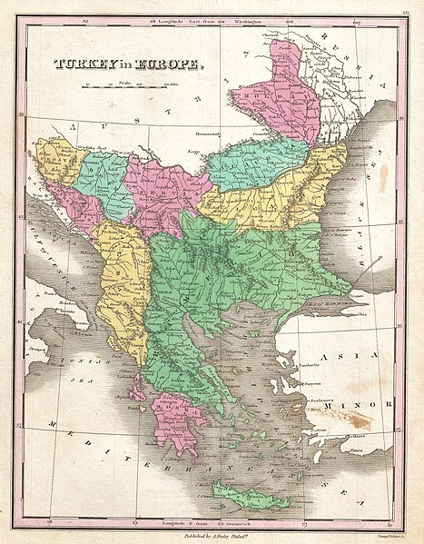
English: A beautiful example of Finley's rare 1827 map of Turkey in Europe. Covers the European lands claimed by the Ottoman Empire in the early 19th century. This includes the modern day nations of Turkey, Greece, Macedonia, Albania, Croatia, Bosnia, Serbia, Montenegro, Bulgaria, Romania and Moldova. In Finley's classic minimalist style, this map identifies cities, forests, river systems, swamps and mountains. Color coded according to regional political boundaries. Title and scale in upper left quadrant. Engraved by Young and Delleker for the 1827 edition of Anthony Finley's General Atlas . |
|||||||||||||
| Datum | 1827 (undated) | |||||||||||||
| Dimenzije | visina: 11,5 in (29,2 cm); Širina: 9 in (22,8 cm) | |||||||||||||
| Inventarni broj |
Geographicus link: TurkeyEurope-finley-1827 |
|||||||||||||
| Izvor/fotograf |
Finley, Anthony, A New General Altas, Comprising a Complete Set of Maps, representing the Grand Divisions of the Globe, Together with the several Empires, Kingdoms and States in the World; Compiled from the Best Authorities, and corrected by the Most Recent Discoveries, Philadelphia, 1827.
|
|||||||||||||
| Dopuštenje (Naknadna uporaba ove datoteke) |
|
|||||||||||||
| Annotations | This image is annotated: View the annotations at Commons |
Povijest datoteke
Kliknite na datum/vrijeme kako biste vidjeli datoteku kakva je tada bila.
| Datum/Vrijeme | Minijatura | Dimenzije | Suradnik | Komentar | |
|---|---|---|---|---|---|
| sadašnja | 17:35, 16. studenoga 2022. | | 2.339 × 3.000 (1,94 MB) | Gyalu22 | Reverted overwriting of artwork |
| 20:45, 8. siječnja 2020. |  | 2.339 × 3.000 (4,01 MB) | Julieta39 | Cleaning freckles, contrast. | |
| 12:10, 23. ožujka 2011. |  | 2.339 × 3.000 (1,94 MB) | BotMultichillT | {{subst:User:Multichill/Geographicus |link=http://www.geographicus.com/P/AntiqueMap/TurkeyEurope-finley-1827 |product_name=1827 Finley Map of Turkey in Europe, Greece and the Balkans |map_title=Turkey in Europe. |description=A beautiful example of Finley' |
Uporaba datoteke
Na ovu sliku vode poveznice sa sljedećih stranica:
Globalna uporaba datoteke
Sljedeći wikiji rabe ovu datoteku:
- Uporaba na de.wikipedia.org
- Uporaba na en.wikipedia.org
- Uporaba na fr.wikipedia.org
- Uporaba na it.wikipedia.org
- Uporaba na ka.wikipedia.org
- Uporaba na ro.wikipedia.org
- Uporaba na sh.wikipedia.org
- Uporaba na sq.wikipedia.org
- Uporaba na tl.wikipedia.org
- Uporaba na tr.wikipedia.org