Datoteka:Croatian Prevlaka in occupation by Montenegro and Serbia.jpg
Viša rezolucija nije dostupna.
Croatian_Prevlaka_in_occupation_by_Montenegro_and_Serbia.jpg (760 × 560 piksela, veličina datoteke: 118 KB, MIME tip: image/jpeg)
| Ova je datoteka sa Zajedničkog poslužitelja i mogu je rabiti drugi projekti. Opis s njezine stranice s opisom datoteke prikazan je ispod. |
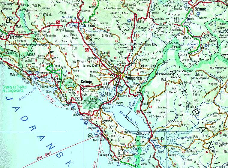
| Opis | Map of Montenegrin Littoral Region and Boka kotorska in the time of occupation of Croatian Prevlaka Region which is the remaining part of Boka kotorska that belongs to Croatia. | |||
| Datum | 1991-2002 (occupation ended 1992-10-20 at 20:30) (UNMIK mission ended 2002-12-20). | |||
| Izvor | Ministry of Foreign Affairs of the State Union Serbia and Montenegro (before that MFA of Federal Republic of Yugoslavia | |||
| Autor | Serbian Official Cartography (Public Service at the time). | |||
| Dopuštenje (Naknadna uporaba ove datoteke) |
|
|||
| Ostale inačice | Geographical version. |

Povijest datoteke
Kliknite na datum/vrijeme kako biste vidjeli datoteku kakva je tada bila.
| Datum/Vrijeme | Minijatura | Dimenzije | Suradnik | Komentar | |
|---|---|---|---|---|---|
| sadašnja | 04:05, 16. veljače 2008. | | 760 × 560 (118 KB) | Imbris~commonswiki | {{Information |Description=Map of Montenegrin ''Littoral Region'' and ''Boka kotorska'' in the time of occupation of Croatian hr:Prevlaka Region which is the remaining part of Boka kotorska that belongs to Croatia. |Source=[http://www.mfa.gov.yu/Fact |
Uporaba datoteke
Na ovu sliku vode poveznice sa sljedećih stranica:
Globalna uporaba datoteke
Sljedeći wikiji rabe ovu datoteku:
- Uporaba na ca.wikipedia.org
- Uporaba na ckb.wikipedia.org
- Uporaba na de.wikipedia.org
- Uporaba na en.wikipedia.org
- Uporaba na fa.wikipedia.org
- Uporaba na id.wikipedia.org
- Uporaba na mzn.wikipedia.org
- Uporaba na nl.wikipedia.org
- Uporaba na ru.wikipedia.org
- Uporaba na sh.wikipedia.org
- Uporaba na sq.wikipedia.org
- Uporaba na www.wikidata.org
- Uporaba na zh.wikipedia.org