Datoteka:Thuja occidentalis range map.png
Veličina ovog prikaza: 589 × 599 piksela. Ostale razlučivosti: 236 × 240 piksela | 472 × 480 piksela | 755 × 768 piksela | 1.007 × 1.024 piksela | 1.644 × 1.672 piksela.
Vidi sliku u punoj veličini (1.644 × 1.672 piksela, veličina datoteke: 381 KB, MIME tip: image/png)
| Ova je datoteka sa Zajedničkog poslužitelja i mogu je rabiti drugi projekti. Opis s njezine stranice s opisom datoteke prikazan je ispod. |
Sažetak
| Opis |
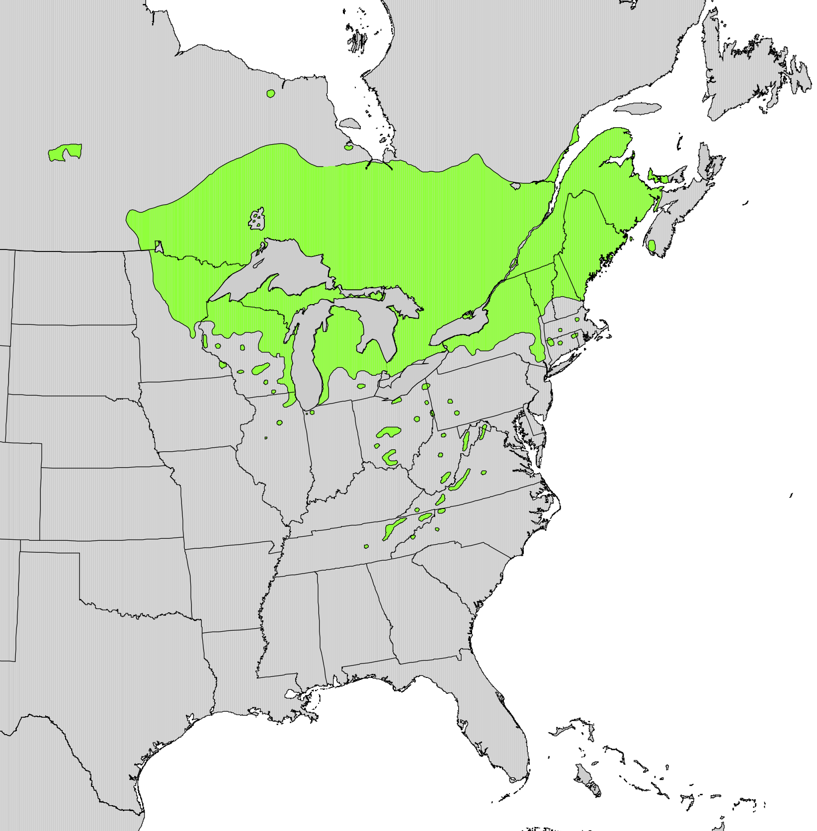
English: Range map of Thuja occidentalis |
|||
| Datum | ||||
| Izvor | Digital representation of "Atlas of United States Trees" by Elbert L. Little, Jr. [1] | |||
| Autor | U.S. Geological Survey | |||
| Dopuštenje (Naknadna uporaba ove datoteke) |
|
Licencija
This work is in the public domain in the United States because it is a work prepared by an officer or employee of the United States Government as part of that person’s official duties under the terms of Title 17, Chapter 1, Section 105 of the US Code.
Note: This only applies to original works of the Federal Government and not to the work of any individual U.S. state, territory, commonwealth, county, municipality, or any other subdivision. This template also does not apply to postage stamp designs published by the United States Postal Service since 1978. (See § 313.6(C)(1) of Compendium of U.S. Copyright Office Practices). It also does not apply to certain US coins; see The US Mint Terms of Use.
|
 | |
| Ova datoteka je identificirana kao slobodna od poznatih ograničenja po zakonu o autorskim pravima, uključujući sva povezana i srodna prava. | ||
Povijest datoteke
Kliknite na datum/vrijeme kako biste vidjeli datoteku kakva je tada bila.
| Datum/Vrijeme | Minijatura | Dimenzije | Suradnik | Komentar | |
|---|---|---|---|---|---|
| sadašnja | 23:21, 11. listopada 2012. | | 1.644 × 1.672 (381 KB) | Pinethicket | {{Information |Description ={{en|1=Range map of ''Thuja occidentalis'' }} |Source =Digital representation of "Atlas of United States Trees" by Elbert L. Little, Jr. [http://esp.cr.usgs.gov/data/atlas/little/] |Author =U.S. Geological... |
Uporaba datoteke
Na ovu sliku vode poveznice sa sljedećih stranica:
Globalna uporaba datoteke
Sljedeći wikiji rabe ovu datoteku:
- Uporaba na ar.wikipedia.org
- Uporaba na arz.wikipedia.org
- Uporaba na ast.wikipedia.org
- Uporaba na bg.wikipedia.org
- Uporaba na ca.wikipedia.org
- Uporaba na ceb.wikipedia.org
- Uporaba na cs.wikipedia.org
- Uporaba na el.wikipedia.org
- Uporaba na en.wikipedia.org
- Uporaba na eu.wikipedia.org
- Uporaba na fa.wikipedia.org
- Uporaba na fr.wikipedia.org
- Uporaba na he.wikipedia.org
- Uporaba na hy.wikipedia.org
- Uporaba na is.wikipedia.org
- Uporaba na ja.wikipedia.org
- Uporaba na mk.wikipedia.org
- Uporaba na nl.wikipedia.org
- Uporaba na nn.wikipedia.org
- Uporaba na no.wikipedia.org
- Uporaba na pl.wikipedia.org
- Uporaba na pt.wikipedia.org
- Uporaba na ro.wikipedia.org
- Uporaba na sk.wikipedia.org
- Uporaba na sl.wikipedia.org
- Uporaba na sv.wikipedia.org
- Uporaba na tr.wikipedia.org
- Uporaba na uk.wikipedia.org
- Uporaba na www.wikidata.org
- Uporaba na zh.wikipedia.org