Datoteka:USA Territorial Growth small.gif
Viša rezolucija nije dostupna.
USA_Territorial_Growth_small.gif (431 × 287 piksela, veličina datoteke: 456 KB, MIME tip: image/gif, animacija se ponavlja, 10 okvira, 30 s)
| Ova je datoteka sa Zajedničkog poslužitelja i mogu je rabiti drugi projekti. Opis s njezine stranice s opisom datoteke prikazan je ispod. |

|
Ova datoteka je zamjenjena s File:USA territorial growth.gif. Preporučuje se rabiti zamjenu.
|

|
Sažetak
| Opis |
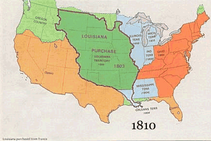
English: US territorial growth 1810–1920, based on the PD USGS maps in Category:Territorial growth maps of the United States.
See key below for explanation of colors.  |
||||||
| Izvor |
|
||||||
| Autor |
|
||||||
| Ostale inačice |
|
Licencija
This image is in the public domain in the United States because it only contains materials that originally came from the United States Geological Survey, an agency of the United States Department of the Interior. For more information, see the official USGS copyright policy.
|
Povijest datoteke
Kliknite na datum/vrijeme kako biste vidjeli datoteku kakva je tada bila.
| Datum/Vrijeme | Minijatura | Dimenzije | Suradnik | Komentar | |
|---|---|---|---|---|---|
| sadašnja | 12:50, 30. svibnja 2006. | | 431 × 287 (456 KB) | Roke~commonswiki | US territorial growth, based on the PD USGS maps in Category:USA Territorial Growth Maps Category: USA Territorial Growth Maps {{PD-USGov-USGS}} |
Uporaba datoteke
Na ovu sliku vode poveznice sa sljedećih stranica:
Globalna uporaba datoteke
Sljedeći wikiji rabe ovu datoteku:
- Uporaba na ar.wikipedia.org
- Uporaba na be-tarask.wikipedia.org
- Uporaba na be.wikipedia.org
- Uporaba na ca.wikipedia.org
- Uporaba na ckb.wikipedia.org
- Uporaba na da.wikipedia.org
- Uporaba na fr.wikipedia.org
- Uporaba na fy.wikipedia.org
- Uporaba na gcr.wikipedia.org
- Uporaba na id.wikipedia.org
- Uporaba na it.wikipedia.org
- Uporaba na jv.wikipedia.org
- Uporaba na kk.wikipedia.org
- Uporaba na ro.wikipedia.org
- Uporaba na sh.wikipedia.org
- Uporaba na sl.wikipedia.org
- Uporaba na sr.wikipedia.org
- Uporaba na tr.wikipedia.org
- Uporaba na uk.wikipedia.org