Datoteka:Position of Auckland Region.png
Viša rezolucija nije dostupna.
Position_of_Auckland_Region.png (405 × 590 piksela, veličina datoteke: 7 KB, MIME tip: image/png)
| Ova je datoteka sa Zajedničkog poslužitelja i mogu je rabiti drugi projekti. Opis s njezine stranice s opisom datoteke prikazan je ispod. |
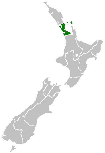
Region of New Zealand, position on the map (source:English Wiki)
| |
Ovo djelo je u javno vlasništvo izdao autor: Furius, at the engleski Wikipedija project. To vrijedi za cijeli svijet. In case this is not legally possible: |
Povijest datoteke
Kliknite na datum/vrijeme kako biste vidjeli datoteku kakva je tada bila.
| Datum/Vrijeme | Minijatura | Dimenzije | Suradnik | Komentar | |
|---|---|---|---|---|---|
| sadašnja | 09:40, 27. travnja 2005. | | 405 × 590 (7 KB) | Domie~commonswiki | Region of New Zealand, position on the map (source:English Wiki) {{PD}} Category:Maps of New Zealand |
Uporaba datoteke
Na ovu sliku vode poveznice sa sljedećih stranica:
Globalna uporaba datoteke
Sljedeći wikiji rabe ovu datoteku:
- Uporaba na ceb.wikipedia.org
- Uporaba na en.wikipedia.org
- Dragon Island
- Colville Channel
- Jellicoe Channel
- Cradock Channel
- Ponui Island
- Anawhata
- Matiatia
- Stockade Hill
- Southdown, New Zealand
- Blackpool, New Zealand
- Waitemata City
- Aiguilles Island
- Te Ārai
- Pakatoa Island
- Papakura City
- Template:Auckland-geo-stub
- Churchill Park, New Zealand
- Mathesons Bay
- Watchman Island
- Airport Oaks
- Chapel Downs
- Windy Canyon
- Mount Hobson (Great Barrier Island)
- Ōhinerau / Mount Hobson
- Lower Nihotupu Reservoir
- Onepoto (volcanic crater)
- Bike Auckland
- Woodcocks, New Zealand
- Tarahiki Island
- Ahuroa
- Tomarata
- Umupuia Beach
- Long Bay Regional Park
- Cosseys Reservoir
- Moturekareka Island
- Papakura Military Camp
- Keri Hill
- Traherne Island
- Franklin County, New Zealand
- Rodney County, New Zealand
- Crater Hill
- Matukutūruru
- Mount Cambria
- Ash Hill, New Zealand
- Ōtāhuhu / Mount Richmond
- Pukaki Lagoon
- Pukeiti (Auckland)
- Te Pou Hawaiki
- Duders Hill
Pogledajte globalnu uporabu ove datoteke.